Welcome to FireScape
|
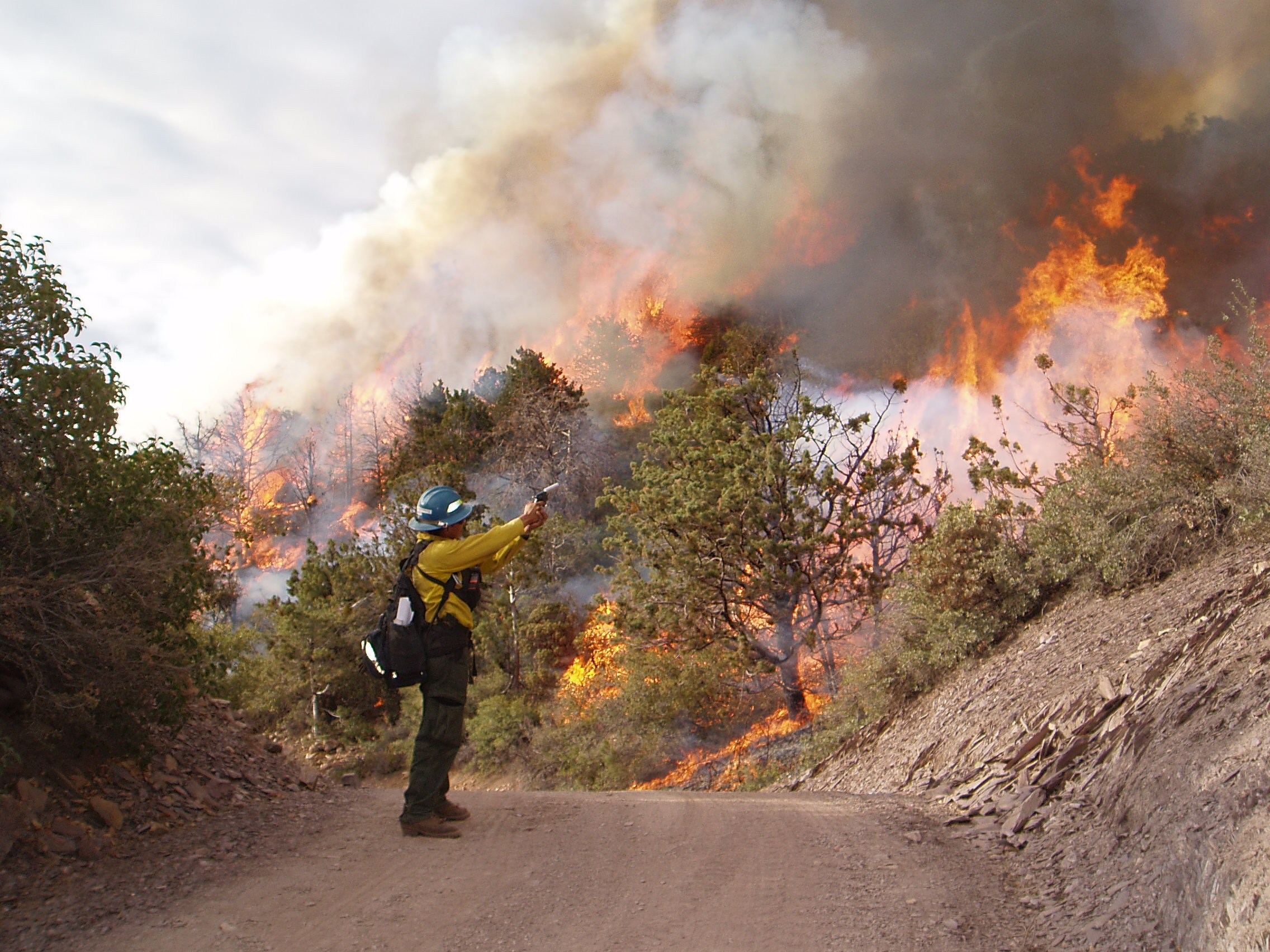
Background: Fire plays a central role in the ecology of Arizona’s Sky Islands, the regional mosaic of mountain ranges rising above the surrounding lowland deserts. Mid-elevation grasslands, woodlands, and forests of the Sky Islands developed over thousands of years under regimes of frequent fire. At the highest elevations, in wet mixed-conifer and spruce-fir forests, fire occurred less frequently (once every few centuries) but played an equally important role in regulating forest development. In lower elevation communities, such as the upland Sonoran desert, spreading fires were historically absent due to the lack of fine fuel to carry the flaming front. Each part of the Arizona landscape has a unique and long-established relationship to fire. The need for action at landscape scales: Managers of public lands in Arizona recognize that these heavy fuel loads need to be reduced, and fire reintroduced as a natural process, to restore the ecological balance of the Sky Islands as well as to reduce the risk of catastrophic fires that threaten human safety and property. Fuel treatments and prescribed burning are among the main strategies used to achieve these objectives. However, the scale of treatments is often small -- often a few hundred acres per year – compared to the scale of the ecological problem, which affects entire mountain ranges. Small-scale treatments simply cannot keep up with the ongoing increases in fuels and the hazard of severe fires. Recognizing this dilemma, the need for landscape-scale strategies has recently become a central vision for restoring the ecological health of the Sky Islands, and indeed across the West. FireScape is our response to the need for landscape-scale fire and ecosystem management. FireScape is a framework for expanding safe, ecologically sound, large-scale fire management across multiple land ownerships in the mountains of southeastern Arizona. The FireScape leadership team includes representatives from the Forest Service, The Nature Conservancy, the University of Arizona (UA), Bureau of Land Management, National Park Service, and other southeastern Arizona land managers. Each Sky Island landscape is a unique biophysical setting with its own management challenges. Thus, each range also requires an individual approach to fire management. The FireScape team works to develop strategies that are appropriate to the needs of each mountain range. No two FireScape projects are alike, but most combine three main elements: 1. FireScape plans are developed collaboratively, by multiple land mangers and other stakeholders, including the public; These elements of FireScape all support the ultimate mission, which is to restore the ecology of the Sky Islands to a dynamic and resilient state. No two projects are alike, but those underway share an approach that includes multiple jurisdictions, UA scientists at the table, assessing treatment need at the whole-mountain scale, and creatively removing implementation barriers. We have completed a fuels map and “departure” analysis for southeastern Arizona that covers the CNF and partner lands. Partners worked together to correct and update Landfire data for a 14 million-acre area. These products provide inputs for fire behavior and effects models to support decision making and outreach. The data used to create these products are available. Email azfirescape@cals.arizona.edu with your request.
To learn more about specific Firescape projects click on a project area below.
|
|